Remote Sensing

We saw the need for remote sensing and we believe it’s the way of the future. We therefore developed a partnership with German remote-sensing leader EOMAP, which not only strengthens our ability to monitor changes in the coastal zone and environmental threats, but to act before problems develop. We can more efficiently map the seafloor and shoreline and, using very high-resolution satellite imagery, track the marine and terrestrial ecology. With the advancing effects of climate change, awareness is key. We can plan and prepare. That’s powerful.

MetOcean Monitoring

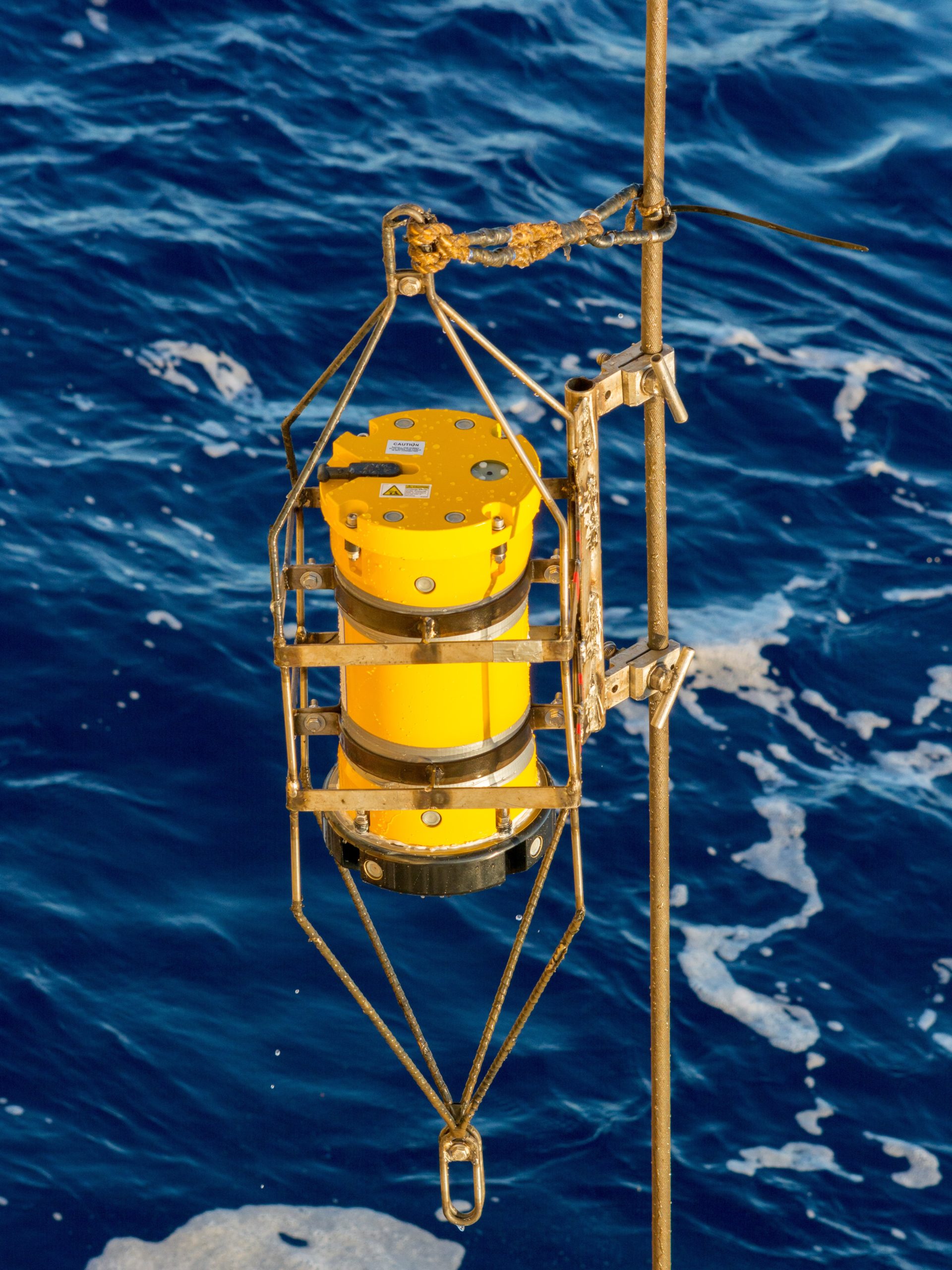
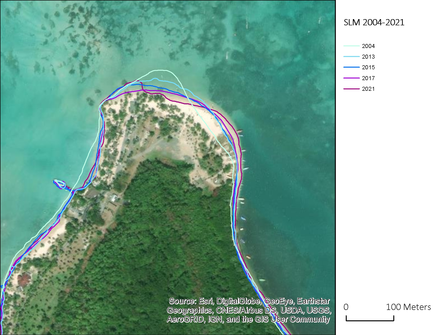
Metocean studies are  fundamental to any coastal and marine engineering design.  A thorough understanding of prevailing  oceanographic and meteorological conditions guides design choices and minimizes uncertainty from the start. Our team has a  profound understanding of ocean processes in and around the Caribbean; we’ve been collecting data here for 25 years and we have an extensive database: wind, waves, currents, bathymetry, water quality, and more. With nearly three decades in business we have developed reliable methods for accurate analysis and predictions. Our services in this area range from marine data collection to modeling of waves, winds and currents, pollutant dispersion and estuarine hydrodynamics.


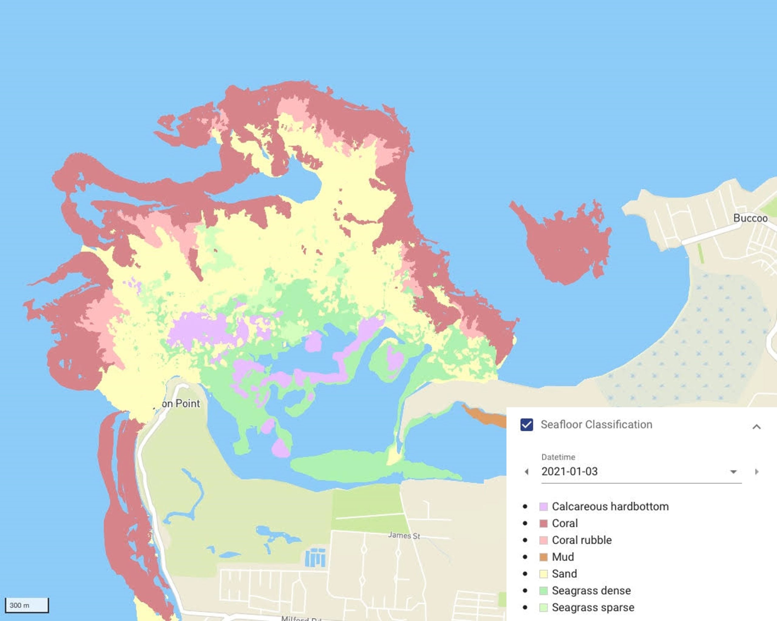
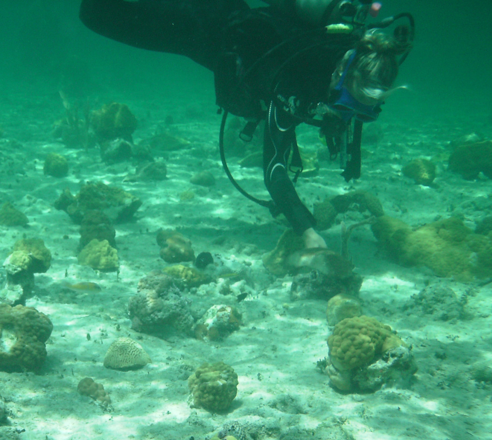
Our environmental experts regularly sample and test nearshore water and sediments to monitor the effect of weather patterns on the beach, vegetation, and nearshore marine species. Precipitation, radiation, and temperature can affect the levels of salinity and the amounts of chlorophyll and dissolved oxygen present in the water. Monitoring of water quality plus satellite data also helps predict flows of sargassum (commonly known as “seaweed”) and treat algal blooms before they threaten the marine environment and beauty of the coast.

Beach and Shoreline Change Monitoring

Beaches and shorelines change constantly and not just after major storms. Studying a shoreline’s historical evolution and modelling the future wave climate, tides, and currents provide valuable information about erosion processes, potential trouble spots, and how to approach beach design. Ideally, after a project’s completion, coastal engineers can establish a baseline that can be used for physical, biological, and economic monitoring. If sand has been placed on the beach or coastal structures added, monitoring allows engineers to track performance and evaluate the success of the design. A healthy beach is the first line of defence against coastal storms and flooding.

Ecosystem and Environmental Health Monitoring

Some of our projects exist in areas that are strictly regulated due to environmental concerns. Often, there are conditions set for development, permits required, and commitments for regular monitoring. Smith Warner cares deeply about the ecosystems we share and is committed to working with our clients and regulators to preserve the beauty and health of our environment. We have experience in safely relocating corals, bromeliads, and seagrasses as well as in setting up nurseries to foster their growth. Regulators and clients trust us to monitor progress according to specifications. We have restored important mangrove forests, maintaining their natural drainage systems and rehabilitating the wetlands around them. The natural beauty of our tropical landscapes, sandy beaches, and turquoise waters is one of the greatest pleasures of living in or visiting the Caribbean. We aim to keep it that way.